When I first started contributing to OpenStreetMap there was a Project of the Week section on the OSM wiki. After much success this eventually came to and end in July 2011. Now, after a three year break, its back in the form of a “wochenaufgabe” (weekly task), for it is the German OpenStreetMap community that has brought back this weekly project.
This weeks task revolves around adding street names to buildings and suggests contributors use the Geofabrik OSM Inspector tool I previously blogged about. Given that I recently helped to map buildings as part of our Shenstone meet-up, I thought I best check the quality of our evenings work.
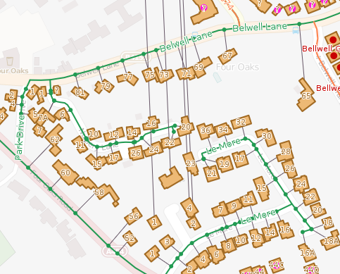
As it turns out, my attention was quickly diverted to the neighbouring town of Sutton Coldfield. As shown in the image above there are a collection of houses in Four Oaks that have a street name that links to Aston Close in Shenstone, 5 miles north (as seen by the lines heading north from each property). The buildings are tagged with addr:street=Aston Close, whilst the nearby Sutton Coldfield street is tagged name=Alston Close. So which is correct – Alston or Aston. We could go back out an survey this close, or turn to OpenData in the form of Land Registry’s Price Paid data.
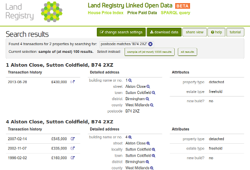
A quick search of the Price Paid data identifies the Sutton Coldfield street as Alston Close. No longer will you end up 5 miles out of the way next time you use OSM to route to this street.


Brian
I got quite confused reading this, until I think I unravelled that there was a typo in the building tags in Sutton Coldfield and you corrected them, which demonstrates the power of the Geofabrik tool as this error wouldn’t have come to light without it. It would be interesting to find out just how great the distance is before this effect does not function
RobJN
Yeah that’s right Brian. Apologies if it didn’t make sense first read through.
vdp
That kind of error can’t happen if using an associatedstreet relation instead of an addr:street tag…